The Great American Road Trip Used to Come With a Side of Awkward Small Talk
When Getting Lost Was Part of the Adventure
Picture this: you're cruising down Interstate 40 in 1995, windows down, classic rock blasting, when suddenly you realize you haven't seen a familiar landmark in about an hour. Your stomach drops as you glance at the crumpled Rand McNally atlas on the passenger seat — the one that's been refolded so many times it looks like origami gone wrong. Time to swallow your pride and find a gas station.
This was the reality of American road trips for generations. Before GPS satellites became our digital co-pilots, navigating cross-country meant relying on paper maps, handwritten directions, and the kindness of strangers at Texaco stations from coast to coast.
The Ritual of the Gas Station Stop
Every long-distance driver knew the drill. You'd pull up to a gas station — preferably one that looked busy enough to suggest the attendants knew their local geography — and approach the counter with a mixture of embarrassment and hope. "Excuse me, could you tell me how to get back to I-75?" became America's most common conversation starter.
The responses varied wildly. Some gas station attendants were local geography wizards, rattling off directions with the confidence of seasoned tour guides: "Take this road about three miles until you see the big water tower, then hang a left at the Dairy Queen." Others would squint at you like you'd asked them to solve calculus, eventually pointing vaguely toward the horizon and muttering, "I think it's thataway."
The really helpful ones would grab a pen and sketch directions on the back of a receipt, creating crude treasure maps that you'd clutch like sacred documents for the next fifty miles.
When Maps Were Weapons of Mass Confusion
Before we could summon turn-by-turn directions with a voice command, road trip navigation was a full-contact sport. Someone in the car — usually the passenger — was designated as the "navigator," a role that came with enormous pressure and frequent blame.
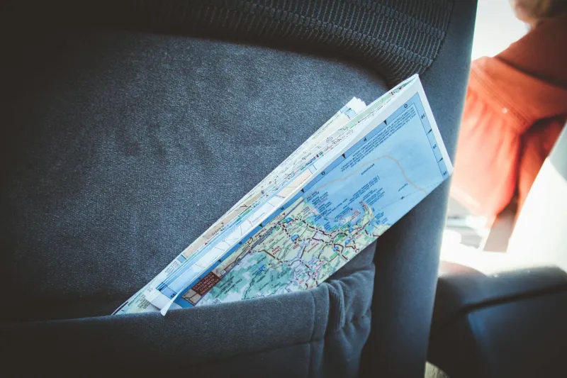
Those massive fold-out maps were engineering marvels of frustration. Unfolding one properly required the spatial reasoning skills of an architect and the patience of a monk. Getting it refolded correctly? Nearly impossible. Most cars from that era had glove compartments stuffed with maps that looked like they'd been through a paper shredder.
The interstate highway system, which seemed so logical on paper, became a maze of numbered routes that somehow managed to run in every direction except the one you needed. Why did I-75 run north-south in some states but seemed to curve east-west in others? These were the mysteries that kept road trippers awake at night.
The Human Element We've Lost
Here's what's genuinely different about modern travel: we've eliminated almost every opportunity for serendipitous human interaction. When you had to stop and ask for directions, you met people. Real people with local accents, strong opinions about the best route to take, and stories about their town.
These weren't always pleasant encounters — some gas station attendants clearly resented being turned into human GPS units — but they were real. You'd learn that the bridge on Route 9 was out, or that there was construction on the main highway, or that the scenic route through the mountains was absolutely worth the extra hour.
Sometimes these conversations led to genuine discoveries. "You're headed to Nashville? You should stop at this little barbecue place about twenty miles up the road. Best ribs you'll ever have." Many of America's favorite road trip memories were born from these chance recommendations from strangers.
The Art of Getting Beautifully Lost
Getting lost wasn't always a disaster — sometimes it was the best part of the trip. Without GPS constantly recalculating and rerouting, wrong turns led to genuine exploration. You'd end up driving through small towns that weren't on your original itinerary, discovering roadside attractions that weren't in any guidebook, and experiencing the America that existed between the planned destinations.
Those unplanned detours taught you geography in a way that following blue lines on a smartphone screen never could. You learned to read the landscape, to understand how rivers and mountains shaped the roads, to recognize the signs that indicated you were approaching a major city or heading into rural territory.
What We Gained and What We Lost
Today's road trips are undeniably more efficient. GPS technology has eliminated the anxiety of getting hopelessly lost, reduced travel times, and made long-distance driving accessible to people who might have been intimidated by the old system. You can drive from New York to Los Angeles with confidence, knowing exactly where you are every mile of the way.
But efficiency isn't everything. Modern navigation has made us passive passengers in our own journeys. We follow the blue line without understanding the terrain, arrive at destinations without really knowing how we got there, and miss the small-town America that exists just off the interstate.
The gas station direction-asking ritual wasn't just about finding your way — it was about connecting with the places you were traveling through. It forced you to slow down, to acknowledge that you were a stranger in someone else's home territory, and to rely on the fundamental human kindness of people willing to help a lost traveler find their way.
That's something no satellite can replace.